


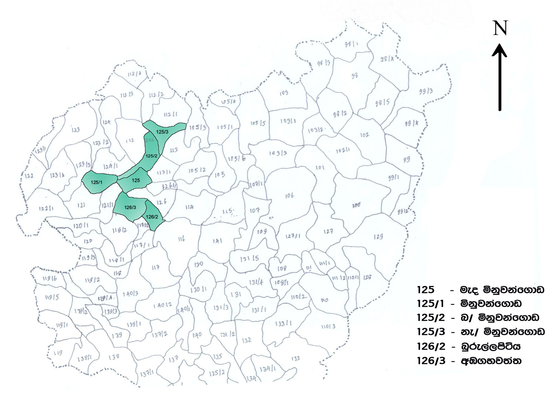
Extent of land in the area of authority of the Urban Council, population and maps. to view large size, Click on the image
Geographical Location
The area of authority of the Minuwangoda Urban Council located within the Minuwangoda electorate in the Dasiya Pattu in Aluthkuru Korala in the Gampaha District of the Western Province which was initially established as a town council in the year 1960 and was subsequently elevated to the status of an Urban Council in 1971 is 4.4 square kilometers. The average temperature of Minuwangoda town which is situated about 15 meters above the mean sea level is 300 Celsius. The annual rainfall ranges between 200-225 inches. The total extent of the UC area is 400 hectares and residential percentage is approximately 60%. The Council also has paddy fields covering 20% of the land and several commercial industries, public sector institutions, parks, playgrounds and roads as well as small areas of coconut and rubber cultivations are also located in the area at present.
The main international airport of the island is just 20 kilometers away from the Minuwangoda town which is the centre of a major road network with roads eading to five directions. Three major highways, i.e the Kandy - Airport road, Colombo-Kurunegala road and Gampaha - Negambo road run across the town.
Details of population in the Urban Council Area (2014)
| No | Grama Niladhari Division | Population | Extent (in hectares) | Male | Female |
| 125 | Minuwangoda Central | 1085 | 50.2 | 564 | 521 |
| 125/1 | Minuwangoda West | 1174 | 67.61 | 574 | 600 |
| 125/2 | Minuwangoda North | 1287 | 60.32 | 594 | 693 |
| 125/3 | Minuwangoda East | 2723 | 30.36 | 1225 | 1498 |
| 126/2 | Burullapitiya | 1020 | 40.48 | 460 | 560 |
| 126/3 | Ambagahawatta | 1385 | 35.27 | 795 | 590 |
| Total | 8674 | 284.24 | 4212 | 4462 |
Population - community wise breakdown
| No | Grama Niladhari Division | Sinhala | Tamil | Muslim | Other | Total |
| 125 | Minuwangoda Central | 773 | 47 | 245 | 20 | 1085 |
| 125/1 | Minuwangoda West | 1140 | 3 | 31 | 1174 | |
| 125/2 | Minuwangoda North | 1252 | 9 | 26 | 1287 | |
| 125/3 | Minuwangoda East | 2706 | 8 | 9 | 2723 | |
| 126/2 | Burullapitiya | 930 | 88 | 2 | 1020 | |
| 126/3 | Ambagahawatta | 1169 | 11 | 205 | 1385 | |
| Total | 7970 | 166 | 518 | 20 | 8674 |
Population - Religion wise breakdown
| No | Grama Niladhari Division | Buddhist | Hindu | Roman Catholic | Islam | Other |
| 125 | Minuwangoda Central | 726 | 46 | 71 | 242 | |
| 125/1 | Minuwangoda West | 999 | 2 | 12 | 31 | 135 |
| 125/2 | Minuwangoda North | 1222 | 39 | 36 | ||
| 125/3 | Minuwangoda East | 2640 | 1 | 73 | 9 | |
| 126/2 | Burullapitiya | 420 | 42 | 556 | 2 | |
| 126/3 | Ambagahawatta | 1019 | 11 | 150 | 205 | |
| Total | 7021 | 102 | 901 | 515 | 135 |